Data
Site Data
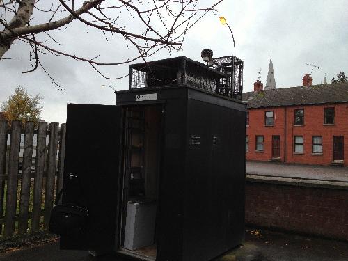
Armagh Lonsdale Road
Last Updated: 19/07/2026 02:00
| Pollutant | Band | Concentration | Period | Last updated |
|---|---|---|---|---|
| Nitric oxide (NO) | Not applicable | 5 µgm-3 | hourly mean | 19/07/2026 02:00 |
| Nitrogen dioxide (NO2) | LOW (1) | 11 µgm-3 | hourly mean | 19/07/2026 02:00 |
| Nitrogen oxides as nitrogen dioxide (NOXasNO2) | Not applicable | 18 µgm-3 | hourly mean | 19/07/2026 02:00 |
| PM10 particulate matter (Hourly measured) | Not applicable | No data | 24 Hour mean | 17/07/2026 14:00 |
| PM2.5 particulate matter (Hourly measured) | LOW (1) | 9 µgm-3 (BAM) | 24 Hour mean | 19/07/2026 02:00 |
| Parameter | Parameter Name |
|---|---|
| NO | Nitric oxide |
| NO2 | Nitrogen dioxide |
| NOXasNO2 | Nitrogen oxides as nitrogen dioxide |
| PM10 | PM10 Particulate Matter |
| NV10 | Non-volatile PM10 (Hourly measured) |
| V10 | Volatile PM10 (Hourly measured) |
| PM2.5 | PM2.5 Particulate Matter |
| M_DIR | Modelled Wind Direction |
| M_SPED | Modelled Wind Speed |
| M_T | Modelled Temperature |
| DIR | Wind Direction |
| SPED | Wind Speed |
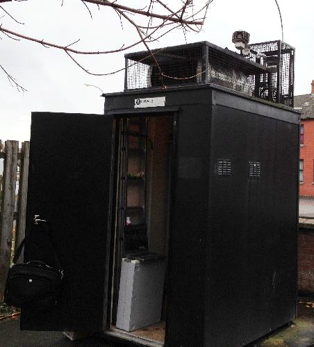
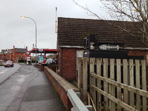
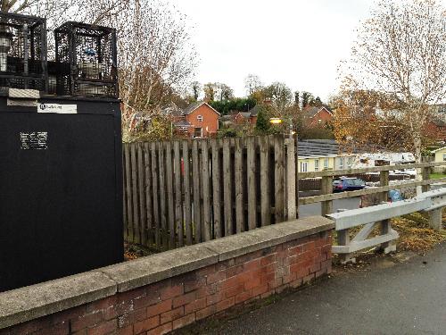
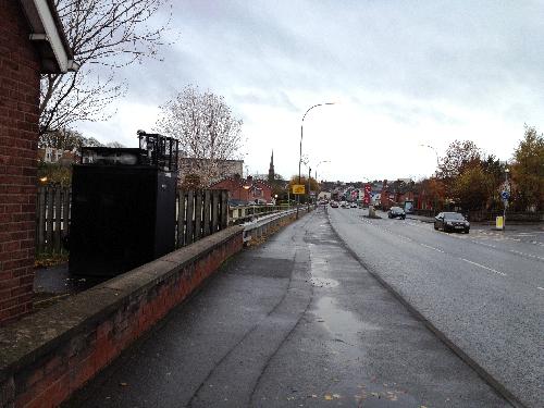
General Information
- Altitude
- 38m
- Coordinates (Lat/Long)
- 54.353744, -6.654532
- Environment Type
- Roadside: A site sampling between 1m of the kerbside of a busy road and the back of the pavement. Typically this will be within 5m of the road, but could be up to 15m.
- Kerb Distance
- 5.4m
- Height
- 2.65 Metres
- Site Comments
- AURN site: known as Armagh Roadside in the AURN. Site is also part of the PAH Network: inlet height for the PAH sampler is 2.7m.
Active Dates
| Parameter | Date Started | Date Ended |
|---|---|---|
| Nitric oxide | 01/01/2005 | - |
| Nitrogen dioxide | 01/01/2005 | - |
| Nitrogen oxides as nitrogen dioxide | 01/01/2005 | - |
| PM10 particulate matter (Hourly measured) | 01/01/2005 | - |
| Non-volatile PM10 (Hourly measured) | 03/09/2010 | 06/02/2020 |
| Volatile PM10 (Hourly measured) | 03/09/2010 | 06/02/2020 |
| PM2.5 particulate matter (Hourly measured) | 05/02/2026 | - |
| Modelled Wind Direction | 01/08/2010 | - |
| Modelled Wind Speed | 01/08/2010 | - |
| Modelled Temperature | 01/08/2010 | - |
| Wind Direction | 01/01/2005 | 03/02/2012 |
| Wind Speed | 01/01/2005 | 03/02/2012 |